+27 82 777 8337
rwheeler@wol.co.za
RUSSELL WHEELER SURVEYS
Member of the South African Geomatics Institute (SAGI)
Member of the Hydrographic Society of South Africa (HSSA)
Registered with the South African Geomatics Council
(SAGC/PLATO) REG No. ES 0464
Registered with the Royal Institute of Chartered Surveyors (RICS) REG No. 6581959
LIDAR & AERIAL SURVEYS
TERRESTRIAL 3D LASER SCANNING
InSAR - SURFACE MONITORING
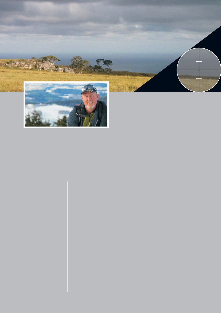
Russell Wheeler Surveys
CONSTRUCTION
(RWS) delivers definitive,
MINING & TAILINGS
dynamic and versatile
TOPOGRAPHICAL
surveying solutions in all
INDUSTRIAL &
spheres of the industry.
HYDROGRAPHIC SURVEYS
30 years of experience ensures
GEOMETRIC ROAD DESIGN
quality deliverables to
exacting standards, anywhere
DIGITAL TERRAIN MODELLING
in Africa and Middle East.
GPS, GEODETIC & GEOSPATIAL CONSULTANT
The level of service comes
straight from the top.
EXPERIENCE THROUGHOUT AFRICA AND MIDDLE EAST
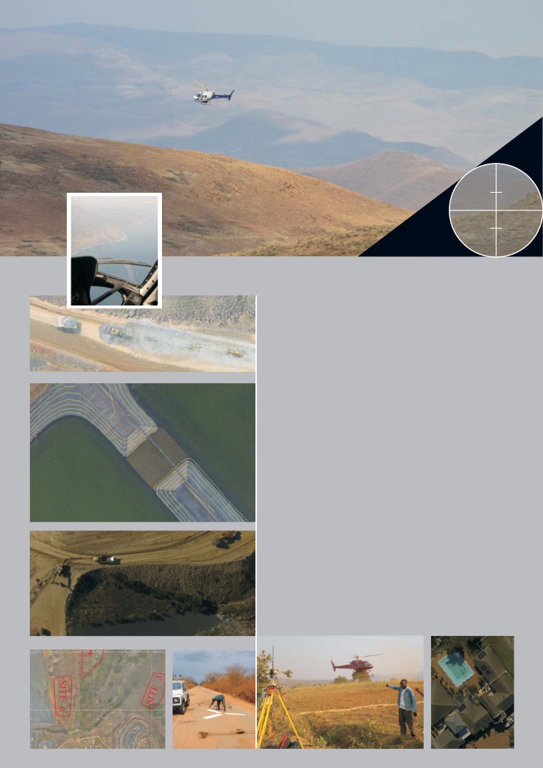
LIDAR & AERIAL SURVEYS
REMOTE SENSING & MAPPING
The RWS - CKAS Joint Venture has done numerous
VOLUME EXTRACTION
projects across Africa, from 100 000 Ha to 30 Ha,
some of them repeated bi-annually for monitoring
and quantity purposes.
Quantities, As-Built Data, Contours and Sections can
easily be extracted from the data.
Typical absolute Lidar accuracies are 3-7cm even in
heavily vegetated terrain.
AS BUILT
SURVEYS
High resolution digital orthophoto mosaics enhance
the data, ‘a picture says a thousand words’. We often
deliver images with 7 sq cm pixels, this is 4 times
industry standard.
We are now able to achieve
2 sq cm pixels
by using
UAV/drones on the smaller projects.
HIGH RESOLUTION IMAGERY
SITE SELECTION
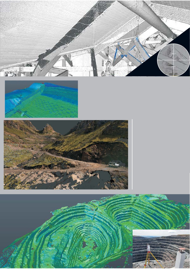
SHORT RANGE
TERRESTRIAL
LASER SCANNING
1 MILLION X,Y,Z,R,G,B
POINTS PER SECOND
MEDIUM RANGE
RWS uses pulse and phase
based scanners for short,
medium and long range
projects.
Data capture with on-the-fly
point cloud registration and
HDR camera yields brilliant
ultra clean data.
Conversion of point cloud into
elements, shapes and CAD.
LONG RANGE OUTDOOR
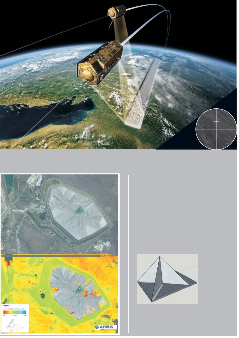
InSAR - SURFACE MOVEMENT MONITORING
NOT AFFECTED BY WEATHER
OR BORDERS
RWS - PMNA Joint Venture uses Xband
radar from TerraSAR-X, TandemX & PAZ
satellite constellations to detect movement
at mm accuracy delivered as :
- Heat Maps
- Time series displacement graphs
- Moisture content change detection
With corner cube reflector network for QA
and calibration.
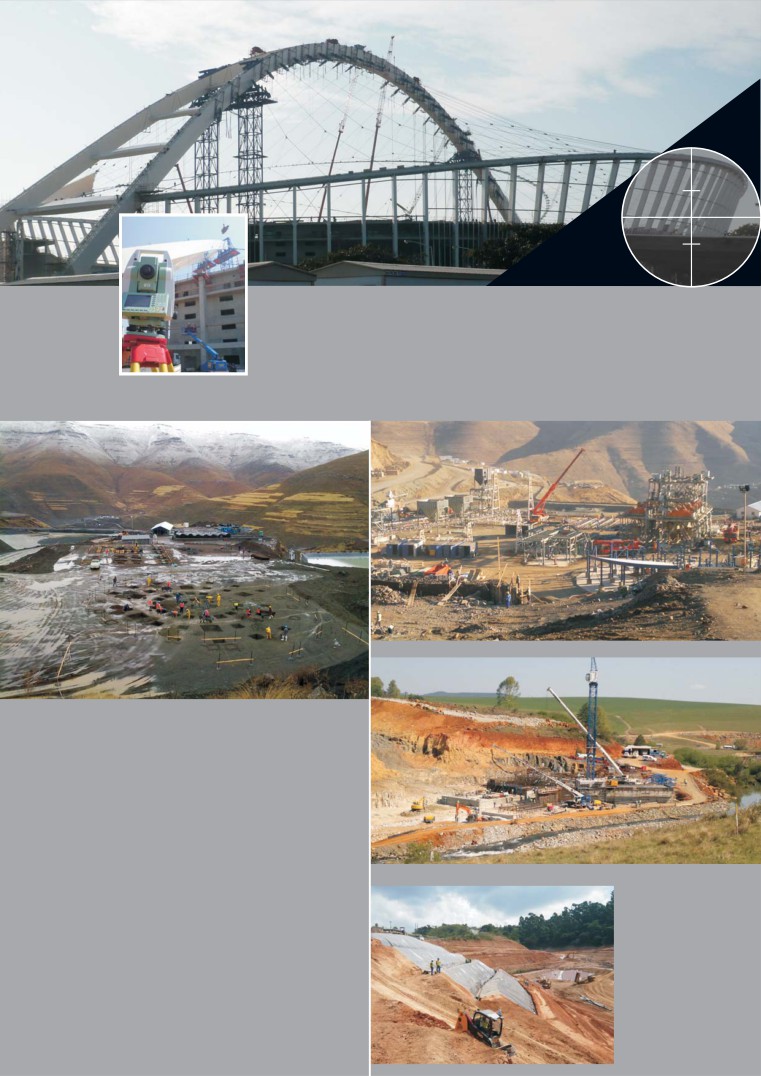
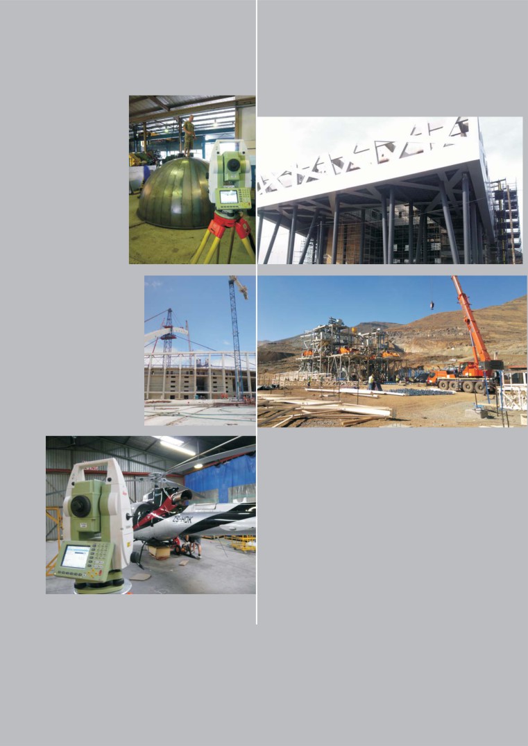
CONSTRUCTION SURVEYS
SUPERVISION & SETTING OUT
RWS was fortunate enough to be involved
with the FIFA World Cup 2010 and ensured
that all the external cladding on the Moses
Mabhida Stadium (Durban) fitted perfectly.
No mean feat considering there were 5
different contractors involved and that the
base of the stadium is roughly circular and its
top, oval.
RWS has handled many earthworks projects
from major dams to thousands of km’s of
roads. This included QA, design, volumes and
setting out.
INDUSTRIAL SURVEY
This is a spin off of Construction and
Topographic Surveys. Experience
ranges from petro-chemical and
aluminum rolling plants to crane rails
and architectural cladding.
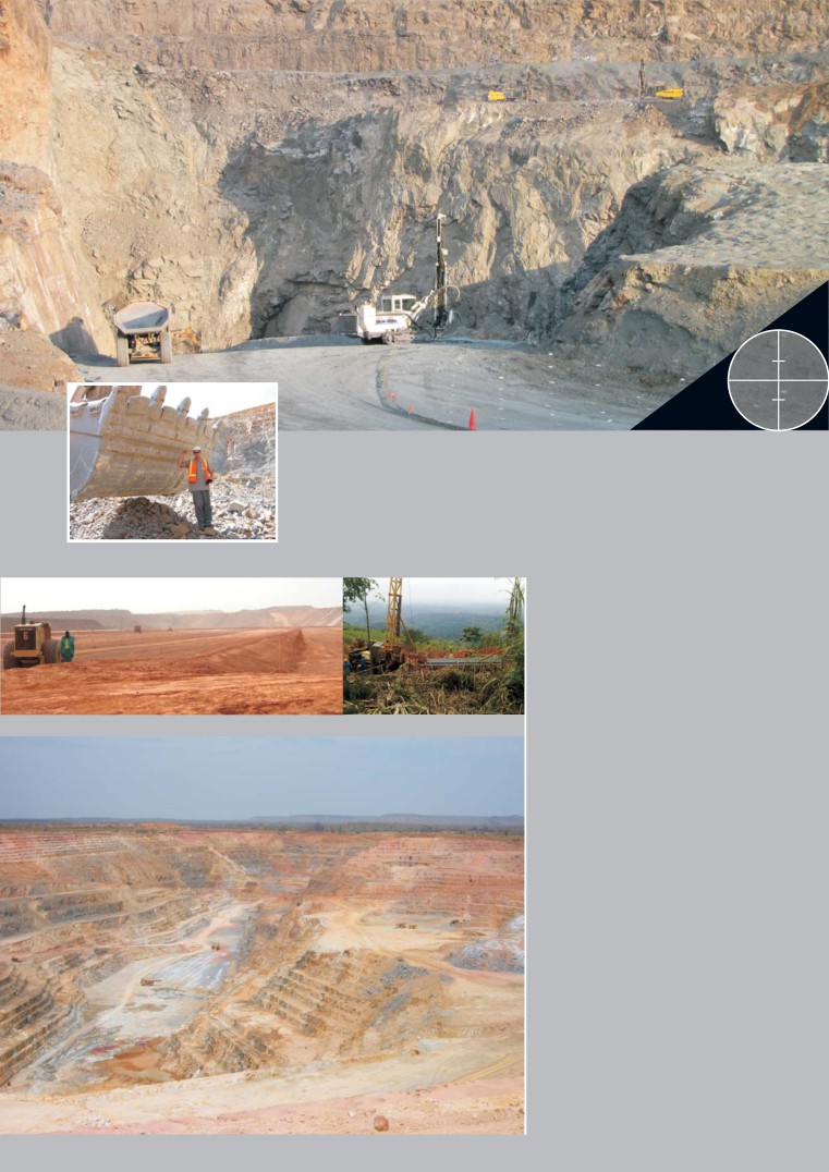
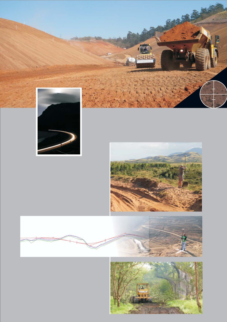
MINE SURVEYS
FROM EXPLORATION
TO MINING
RWS assists mining companies
from exploration right through
to mining operations. Most of
our experience has been in
Open Cast where work includes
measuring pits, stock piles,
waste dumps and dams.
Geological exploration involves
either measuring bore holes and
providing surface models or
setting up systems to enable the
geologist to survey the bore
holes themselves.
Another area of expertise is
geospatial planning and site
selection , with limited under
ground experience.
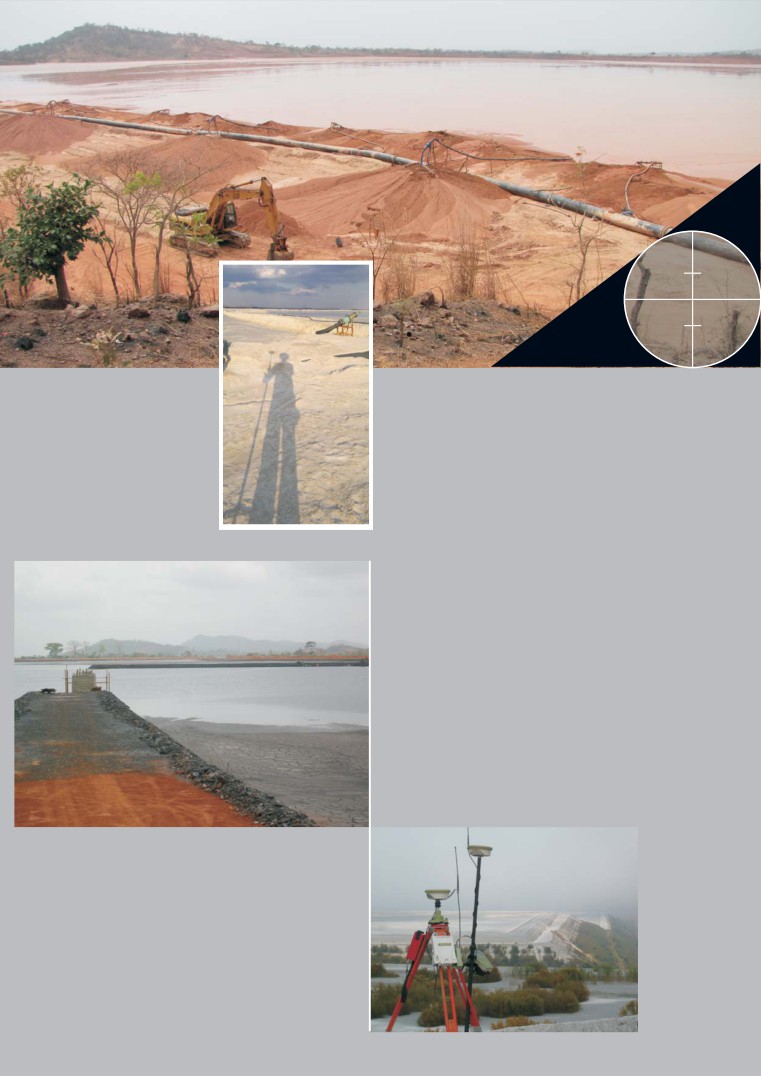
TAILINGS DAMS
TAILINGS PROJECTS
RWS has been involved with numerous tailings
dams associated with platinum, diamond, gold
and manganese mines across Africa.
Some projects involve identifying potential
sites and surveying them, followed by
modelling potential dams for feasibility
studies, others are the setting out the starter
walls and infrastructure for the construction of
new dams.
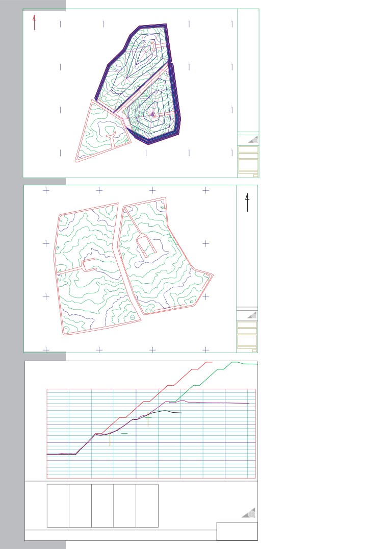
ANNUAL SURVEYS
Annual surveys are carried out in
accordance with DME regulations to
determine rate of rise, storm capacity,
freeboard, etc. Cross sectioning of the
piezo-meter lines is also undertaken for
stability analysis.
2011
COMPARTMENT 2
TOE = 1314.0
FUTURE
T
N
CREST = 1364.1
CAPACITY
+ 2980000 X
+ 2980000 X
+ 2980000 X
PENSTOCK = 1361.7
+ 2980000 X
7 692 116 m3
BEACH AREA = 44.669 Ha
CATCHMENT AREA = 51.319 Ha
HEIGHT = 50.1 m
STAGE
CAPACITY
1350
FROM
1351
TO
VOL
139
AREA700
FUTURE
13511352
13521353
86169282724
192956351644
13531354
13541355
375888381961
384632384868
TOE = 1314.0
1355
1356
380336
383724
CREST = 1374.0
13561357
13571358
376883375423
383072380528
PENSTOCK = 1372.0
13581359
13591360
378307377538
382088380524
BEACH AREA = 35.159 Ha
136013611362
136113621363
375773373846371994
378884376984375228
CATCHMENT AREA = 36.509 Ha
1363
1364
370165
372960
HEIGHT = 60.0 m
13641365
13651366
368481366800
369844368908
1366
1367
1367
1368
365047
363265
366392
364548
1368
1369
1369
1370
361850
360890
362936
361772
1370
1371
1371
1372
360342
354149
361004
360688
+ 2980500 X
+ 2980500 X
+ 2980500 X
13721373
13731374
33165
250984
392289423890
1352.0
Future life of facility
2011
TOE = 1313.2
modelled on top of
CREST = 1353.4
PENSTOCK = 1351.0
+ 2981000 X
BEACH AREA = 34.617 Ha
+ 2981000 X
FUTURE
CATCHMENT AREA = 42.389 Ha
TOE = 1313.7
HEIGHT = 40.2 m
annual as-built survey.
CREST = 1379.0
PENSTOCK = 1377.0
BEACH AREA = 21.868 Ha
CATCHMENT AREA = 23.285 Ha
FUTURE
HEIGHT = 65.3 m
TOE = 1313.2
CREST = 1373.4
PENSTOCK = 1371.4
Scale 1:2500
2011
BEACH AREA = 34.617 Ha
CATCHMENT AREA = 42.389 Ha
TOE = 1313.7
HEIGHT = 60.2 m
CREST = 1375.0
PENSTOCK = 1372.6
BEACH AREA = 22.042 Ha
RUSSELL WHEELER SURVEYS
CATCHMENT AREA = 25.870 Ha
Client
HEIGHT = 61.3 m
+ 2981500 X
+ 2981500 X
+ 2981500 X
+ 2981500 X
Contract
Title
2011 ANNUAL SURVEY
OF VRO WEST COMPLEX
COMPARTMENT 1 , 2 &
GRASS DAM AND
FINAL DESIGN
Drawing No
Rev No
+ 2924500 X
+ 2924500 X
+ 2924500 X
+ 2924500 X
T
N
Annual beach survey derived
+ 2925000 X
+ 2925000 X
from Lidar, 0,2m contours.
TOE = 1606.8
CREST = 1651.2
PENSTOCK = 1648.6
AREA = 55.795 Ha
HEIGHT = 44.4 m
AREA = 66.435 Ha
HEIGHT = 40.0 m
+ 2925500 X
+ 2925500 X
Scale 1:2000
TOE = 1592.6
CREST = 1632.6
PENSTOCK = 1629.3
Client
RUSSELL WHEELER SURVEYS
Contract
Title
2011 ANNUAL SURVEY OF
WEST WITS - SAVUKA
TSF - 7A & 7B
+ 2926000 X
+ 2926000 X
+ 2926000 X
+ 2926000 X
Drawing No
Rev No
POTENTIAL EXPANSION
FUTURE LIFE OF
FACILITY DESIGN
2011
1358
2007
As-built cross section on
1348
1B
piezometer line and future
1338
design super-imposed
1A
1328
Datum 1318.000
Chainages
0
25
50
75
100
125
150
175
200
225
Chainages
Level
Description
Westing
Southing
2007 TABLE (BLACK LINE), SEE SPREADSHEET FOR
0.00
1331.26
A1
28492.98
2980180.34
2011 DATA EXTRACTED FROM LIDAR SURVEY
32.53
1331.32
TOE
PEIZOS SURVEYED IN 2007 & 2008
54.40
1342.86
1A = 70.71 m / 1344.00
56.78
1342.15
1B = 113.40m / 1354.84
60.48
1341.96
70.21
1342.86
70.71
1344.00
PIEZO
79.52
1344.89
96.84
1351.21
97.80
1350.73
101.08
1350.81
118.39
1354.62
132.76
1356.02
RUSSELL WHEELER SURVEYS
140.86
1354.81
151.33
1354.45
A2
28644.22
2980175.45
SCALES
PIEZOMETER LINE 1 (AA)
Horizontal Scale: 1000
WEST EXTENTION - VRO
Vertical Scale :500
2007 & 2011
TOPOGRAPHICAL SURVEYS
DTMs & DEMs
RWS has surveyed hundreds of thousands of Ha’s
using total stations, GPS, Laser Range Finders and
Lidar. The deliverable is usually a Digital Terrain Model
(DTM) also known as a Digital Elevation Model (DEM)
as well as CAD drawings and 3D contours.
CONTROL
Behind the scenes a control
network generally needs to be
implemented to ensure that
the data is correctly
positioned.
APPROPRIATE EQUIPMENT
Different environments and project
sizes require different technologies.
GPS performs well in the open but can
be augmented with Laser Range
Finders in heavily vegetated sites.
RWS has experience ranging from
deserts to jungles, sea level to 4500m
mountains.
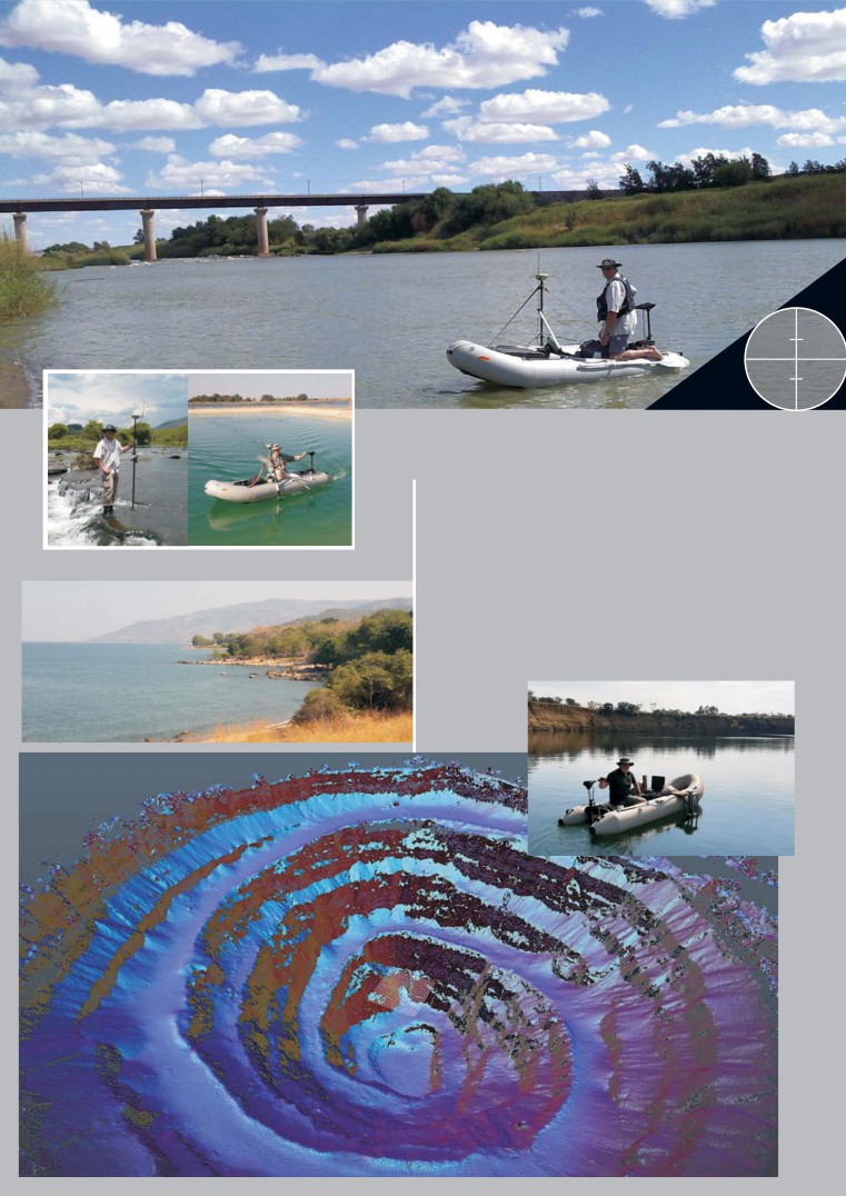
HYDROGRAPHIC SURVEYS
BATHYMETRY
Hydrographic and under water surveys are spliced
into topographic models derived from both
terrestrial and airborne lidar.
Tailings dams, flooded pits, return water dams,
rivers and harbours have been surveyed with both
single and multi beam echo sounders.
GEOMETRIC ROAD DESIGN
ON SITE SUPERVISION & DESIGN
Russell Wheeler Surveys has been
involved on numerous large road and
other major projects requiring access and
is totally au fait with all aspects of such
projects.
Our skills include setting up control
networks, managing site survey staff,
geometric alignments and realignments
of existing roads, computing and
agreeing quantities, managing the quality
control of the layerworks thickness and
level, calculating various scenarios to
reduce project costs.
DIGITAL TERRAIN MODELLING
Digital terrain models (DTMs) are used to
depict existing topography, additional
design elements, such as platforms or
roads, can be integrated into the project
to balance the cut and fill as well as
determine volumes.
Potential tailings dams can be modelled in
DESIGN & QUANTIFICATION
3D to calculated stage capacities and
starter wall volumes thus optimising the
design thereby reducing costs.
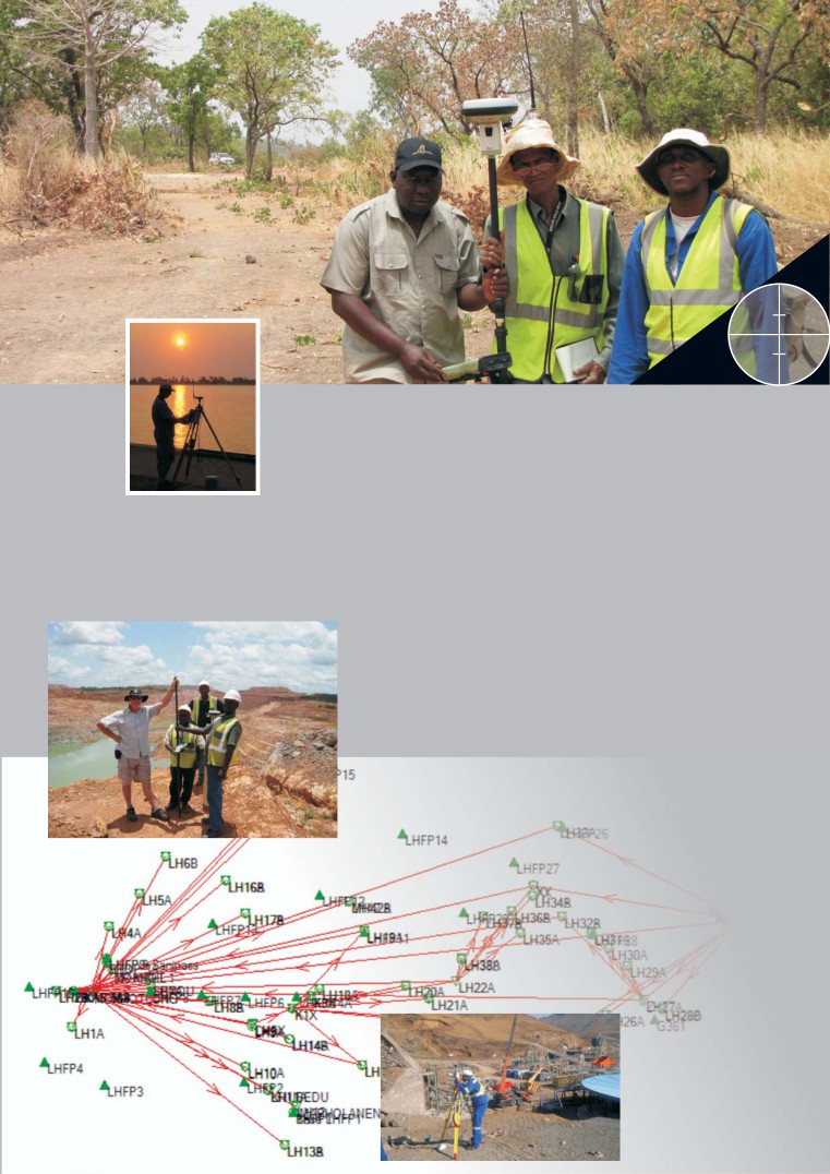
GPS, GEODETIC &
GEOSPATIAL CONSULTANT
GPS
CADASTRAL
GEODETIC
The supply, installation and training of
Numerous projects in SA from
We are skilled at :
differential GPS to mining companies.
large scale subdivisions of
Setting up control networks,
national roads and major dams
converting data between
down to small individual servi-
ellipsoids such as Clarke 1880
tudes in urban environments.
& WGS 84.
An interesting project was the
Computing height
framing of the parent properties
transformations or applying
for the old tribal boundaries in
geoidal models.
the former Transkei.
Post processing static data in
combination with real time
data to compute GPS vectors.
Building permanent reference
monuments / beacons to be
used in future phases in a
project.
Producing and compiling, or
auditing survey reports.
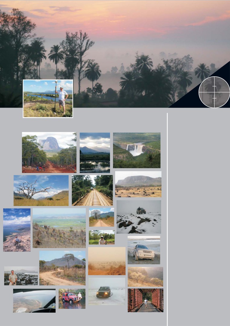
AFRICA
EXPERIENCE IN
Senegal
Guinea
‘been anywhere interesting lately’
Mali
Burkina Faso
Ghana
Cameroon
DRC
Republic of Congo
Rwanda
Ethiopia
Kenya
Tanzania
Malawi
SOUTHERN AFRICA
Angola
Namibia
Zambia
Zimbabwe
Mozambique
Madagascar
Swaziland
Lesotho
South Africa
MIDDLE EAST
Qatar
UAE
AMERICAS
USA
Colombia
Brazil
Argentina
AUSTRALIA